AMERICAN SAMOA
Population
Total: 44,620 (2023 est.) (also 49,710 from 2020 DECIA which matches up with the Population by gender line)
Age Structure: 0-14 years: 25.91%; 15-64 years: 65.89%; 65 years and over: 8.2% (2023 est)
Population by gender: male 50.8%, female 49.2%
Urban population: 87.2% of total population (2023)
Rate of urbanization: 0.26% annual rate of change (2020-25)
Total fertility rate: 2.13 children born/woman (2023)
Diabetes Rate: Prevalence (age-adjusted 20-79 years) – 20.3%; proportion of people with undiagnosed diabetes – 51.5% (2021) 45.4%
Sanitation facility access: improved, 99% of population; unimproved, 1% of population (2020 est)
Drinking water source: improved, 99.8% of population; unimproved, 0.2% of population (2020 est)
Ethnicity: Pacific Islander 88.7% (Samoan 83.2%, Tongan 2.2.%, other 3.3%), Asian 5.8%, (Filipino 3.4%, other 2.4%), mixed 4.4%, other 1.1% (2020 est)
Languages: Samoan (88.6%), English (3.9%), Tongan (2.7%), other Pacific islander (3%), other (1.8%) (2010 est)
Literacy: 97% (1980)
Economy
eal GDP: $658 million
GDP per capita: $11,200 per capita (2016 est); $12,845 (2020 est) (different sources)
GDP composition by sector of origin: agriculture 27.4%, industry 12.4%, services 60.2% (2012)
Unemployment rate: 13.2% (2020)
Labor force by occupation (2015): agriculture (N/A), industry (15.5%), services (46.4%)
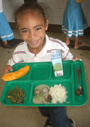
Poverty: 50.7% of families (2019)
WIC: $78.91 average monthly benefit per person (preliminary FY2022)
Agricultural Product: bananas, coconuts, vegetables, taro, breadfruit, yams, copra, pineapples, papayas; dairy products, livestock
Top Industries: tuna canneries (largely supplied by foreign fishing vessels), handicrafts
Exports: $428 million in current year dollars (2016 est.); Major export: canned tuna
Imports: $615 million (2016 est.); Major imports: raw materials for canneries, food, petroleum products, machinery and parts
Transportation
Airport (3, all paved), Roadway (241 km), Pago Pago seaport (deepwater harbor)
Geography
Land: 224 sq km of five volcanic islands with rugged peaks and limited coastal plains, including Rose Atoll and Swains Island (coral atolls)
Natural Resource: pumice, pumicite
Land Use: agricultural land (24.5%) – arable land (15%), permanent crops (9.5%); forest (75.5%) (2018)
Climate: Tropical marine, moderated by southeast trade winds; annual rainfall averages about 3 m; rainy season (November to April), dry season (May to October); little seasonal temperature variation. The harbor in Pago Pago is one of the best and most strategic natural deepwater harbors in the South Pacific Ocean due to its sheltering shape and peripheral mountains.Environmental-current issue: There has been limited/no volcanic activity since the 19th century. E. coli and leptospirosis infection risk from pig and human waste in waterways (wash into streams, soil erosion, storms moving sediment). Climate change impacts: Rising temperatures and heat waves; stronger tropical storms and cyclones resulting in damage (cyclones are common from December to March); sea level rise impacts on infrastructure, drinking water, agriculture, housing, transportation, ecosystems, and cultural sites; coastal flooding and erosion; and coral bleaching and economic impacts of coral reef loss/degradation. Invasive plants and animals in conserved areas.